Last Sunday we drove all the way to Chieveley only to arrive in pouring rain, so abandoned the ride. Better luck today. Blue skies from the off.
We have done this route or similar once or twice before, but I've not really got the geography of parts of this area in my head yet.... so some will be a big surprise.😁
 |
| shooting into the sun at 10am as we set off from Chieveley |
Through the edge of Chieveley village, we crossed under the A34 and over the M4. We were cycling into wind and also had the noise of the motorway traffic, but as soon as turned left into Old Street, just short of Hermitage, it was instantly calm. It's a gradual up hill for about the next 5 miles to pass under the A34 at Worlds End, and turn right towards Beedon Hill.... HILL. Yes, still up hill. We detoured to visit the church here on our last trip, but continued straight through today, with the exception of a quick photo of this old barn, to remind me what's at Beedon.
Continuing, we soon pass through Stanmore, where this pretty barn was on our right.
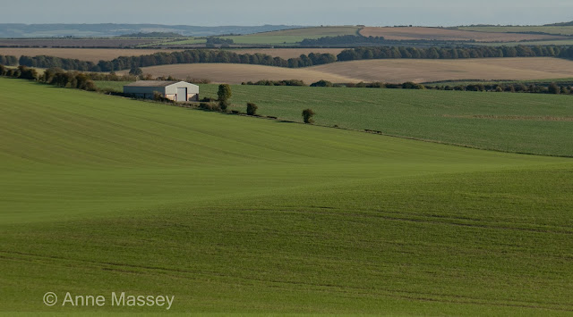
We're at the top of our climb now, and enjoy a fast downhill, followed immediately by an up hill, to this spot where we have stopped before to admire the fabulous views. And take a few photos.
 |
| Stamore farm |
We're at the top of our climb now, and enjoy a fast downhill, followed immediately by an up hill, to this spot where we have stopped before to admire the fabulous views. And take a few photos.
 |
| 50 yards further along the road |
 |
| Liked the play of light and shade on this West Ilsley cottage, as we rode through just opposite the church |
Now for our next climb, just passed West Ilsley pond, into Catmore Road. Another bit of a slog, infact I stopped part way up, considering a photo looking back, didnt both to take it, but struggled to get going again. I did pull over once it flatted out, to look back, and also since I liked the look of the clouds shadows on the ploughed fields to our left.
 |
| looking back, on Catmore Road |

Almost a dog left at the next junction, left then right into Long Lane at Lilley. At the next junction, the church at Brightwalton would be just on our left, but today, we turned right, heading to the Honesty Cafe, Saddleback Farmshop at Farnborough,
 |
| Cafe entrance. |
 |
| Need to do some dusting! |
 |
| Not a bad view for our stop |
 |
| Terrible photo, but this was a herd of deer, visible from the cafe |
We did a loop now, UP from the cafe, to Farnborough village, which is a steep climb at the end, and where we turned left today. The road flatted out for a bit, on Copperage Road. A left turn at the next junction and now a steep downhill, turning right after about half a mile, into a road with no name, with plenty of woodland. The temperature dropped a few degrees through here! At a XRoads we turned left, with a very steep uphill (13%) back up to Brightwalton. That warmed us up again.
I had no recollection of the next section from previous rides, but we came into Leckhampstead, where, just for reference I photographed the war memorial.
 |
| Leckhampstead War Memorial |
We soon dropped down this hill, and John commented that he couldn't quite picture where we were, which is unusual. So, I stopped to grab this next photo for reference. By the time I joined him to turn left at the bottom, he realised that we had come up this road quite recently, when Daphne joined us one day, using John's ebike. (the exposed windy road to Boxford coming up).
 |
| Pretty views as we drop down to join Hangman's Stone Lane, into Boxford |
 |
| Ploughed fields as we ride on the road "windy" road into Boxford |
We got separated a little on this road, and as I checked the route profile, I could see a BIG hill ahead. Power at the ready, I realised it was the left turn to Winterbourne out of Boxford. The problem was that Garmin was telling me to go straight on, but only because last time, we had done that, just for 100 yards or so, then turned back. So, I avoided that detour and went straight up the hill. I waited a few minutes at the top, before John appeared. He had decided best to go straight on, incase I hadn't realised the error.😄. I was very impressed when he reminded me that the first time I did this hill was on my gravel bike, on Christmas Eve, with Gill. It's steep! And a second hill is almost upon us.
 |
| Nice wooded section on Winterbourne Road. John recons he got his "shot of the day" here, of an old dead tree. |


