May Bank holiday Monday and whilst the rest of England heads to queue for the coast, with a forecast of 23 degrees, we headed for Bradfield. John was due to ride with DD today, and me with Linda. My plan was for Linda and me to get a lift to Bradfield, and ride home. But DD came off his bike yesterday and is injured, so I offered to accompany John with Linda joining us.
A few new sections for me today, or the wrong way round sometimes. Linda has done some walking in parts of this area, but never cycled from here before. She loves hills, so no problem😊
Route
From our usual parking spot in Dark Lane, we rode downhill under the M4, immediately followed by our first climb, which, when not properly warmed up, is always a challenge. It was also pretty chilly at this point, and goosebumps in abundance! Turning left at our first junction, we were under tree cover so a bit shady. We took the left fork along this road (new for me), then straight over at the next junction heading to Upper Basildon, on a steady gentle uphill.
We just skirted the edge of the village, taking the Ashampstead Road. This crosses straight over at a Xroads at this white cottage, then climbs a bit.
 |
| Crossing and continuing on Ashampstead road to the right of this cottage |
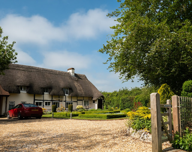
As the road levels out, some lovely red poppies near the post box, with a pretty thatch just opposite. This Hamlet is Quicks Green.
 |
| Waiting for the photographer at the red poppies. |
Next we turn sharp left into Whitemoor Lane, which is a bit of a welcome downhill, and which ends at another XRoads with lovely crop fields opposite. Linda continues ahead whilst John and I take a few photos. This next climb is quite long, but gentle.
 |
| Eling Hill Cottage |
 |
| Eling Hill cottage Iris |
A left turn next onto Everington Lane, which takes us all the way into Yattendon, arriving from a different direction than I have ever done before. Its a fast main road, but quite a textured surface, so seemed like hard work as it rose slightly on the last section approaching Yattendon. No one else at The Pantry as we arrived, but within 10 mins it was chocca.
 |
| Tea and cake stop in Yattendon. |
 |
| Yattendon centre |
Refreshed, we left only to halt a moment later as Linda announced she had a puncture. Oh no! We went back to the village centre, and our knight in shining armour, aka John, sorted it in no time. (despite the fact that Linda had the wrong size inner tub with her - wrongly supplied by Specialise shop!) Fortunately my tyres same size.
 |
| Or did Linda fix it herself? |
We pass the West Berkshire Brewery now on our left, over the M4, and turned right through Frilsham Woods. All very pretty with lovely light, but uphill for a while. Then at last a downhill hill section and straight over into Wellhouse Lane. (I have come this way from the opposite direction). At the end of Wellhouse Lane, a left turn to Marlston Hermitage, passing the lovely old school building on or right.
 |
| Marlston College |
Not far past the college and round a bend, we turn left onto flatter lanes following the river Pang, to Bucklebury ford. A few kids paddling today. We cross the ford on the bridge.
 |
| Bucklebury Ford |
Left after the ford into Bucklebury, and a brief stop at the church.
 |
| Bucklebury Church |
 |
| opposite the church, Bucklebury |
We turn left at the church, and now heading towards Stanford Dingley, all very easy going now. (John decided to take out a couple of extra climbs he had planned.... thankfully!). A dogleg at Stanford Dingley, into Back Lane, and a straight run now all the way back to the start, on Dark Lane.
The original route had been about 30 miles, and loosing a couple of hills, ended up being 25 miles. Both John and I agreed, yet Linda who also has a Garmin clocked up 33.4 miles at an average of 14.46. Very strange since she road along me the whole way and my average was 11.1mph! Technology for you.
Thanks for your company. And relax.


