Just Daphne free today, and no Dave either. The Inkpen Crocus field was on my list of things to visit in March, so was hoping it was worth a look today as part of this route. John planned this route removing the biggest climb to Coombe Gibbet which is definitely one for ebikes!
As we arrived in Washwater, the road to the NT car park we use, had a ROAD CLOSED sign. Diversions signs involved a couple of left turns and we were able to approach from the other side. We were then able to cycle through between the many work vehicles, as they were just setting up for a week long closure. It started to drizzle.
After less than a mile, the drizzle became more persistent ie rain! So we stopped for Daphne and I to put on our rain jackets. We had all started out with fingerless gloves today.... and my hands were now freezing. 😔
However, we soon warmed up, on a very gradual climb away from Washwater on Penwood Road, which is a nice quiet lane, passing under the A34, and between old woods either side.
 |
| Penwood Road, leaving Washwater |
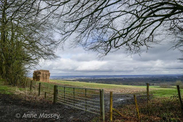
Next we wiggled around the area near Highclere, with some amazing views, after some more climbing. Infact the first 7.5miles of this route were uphill today.
 |
| I think this was Tubbs Lane, after a climb. A quick stop to remove our rain jackets as now too hot! |
 |
| same spot. A tiny Hamlet on Tubbs Lane. |
Next we joined Hollington Lane, and I recognised the start of a long slog to Ashmansworth. I made it, but it is a tough climb. Daphne did pretty well, just pushing a short section, then got back on.
 |
| Blurry shot by John due to my speeeeed. Part way up the lane to Ashmanworth.😂 |
 |
| Ashmansworth topiary. (the road to Faccombe turns off here) |
 |
| Ashmansworth |
 |
| Lovely cottages in Ashmansworth, but now we turn around. |
 |
The quiet lanes to East Woodhay undulated up and down and occasionally a little challenging, but once again, the view at the top was worth it.
 |
| Views from the unnamed road towards East Woodhay. |
 |
| And a bit further along. A deer came out of this field behind us. |
We are soon to visit a restaurant in East Woodhay for lunch with friends, and it also has a beautiful garden which opens a handful of times each year. (I learned about it from the lady who owns Inkpen Rectory, and whose garden I am also visiting in summer)
 |
| Soon we come into West Woodhay, passing the impressive house. Shame the blossoms are still a week or two from flowering. |
A few more undulations (uphill!) and I was lagging behind a bit. Was glad to arrive in Inkpen at the Crown and Garter Honesty Cafe.
 |
| Honesty Inkpen. |
No one else there when we arrived. We sat in the garden, with jackets back on, since it was a little cool, but fine. We chatted to a couple of male cyclists as we left, who had come from Frilsham, and were able to advise us that Bucklebury Ford is still very flooded as is Back Lane to Stanford Dingley. So will avoid that area a bit longer.
 |
| Very sparse, so not exactly a blaze of colour. But the surrounding landscape is beautiful |
 |
| Mobile phone shot. |
 |
John getting wet knees for his shot..... |
 |
| Looking left at the X Roads. |
 |
| John and Daphne carried on as I stopped for the photos at the X Roads. |
Next we joined the A338 all downhill or flat,for about half a mile, before a right turn, and a chance to improve our average speed, which at this point was below 10mph 😂. (Lots of climbing earlier, but also very messy roads so needed to pick our way through potholes and puddles at times. )
 |
| This "Geese on Guard" signage, just before the retirement village. They also had a goose weather vane. |


